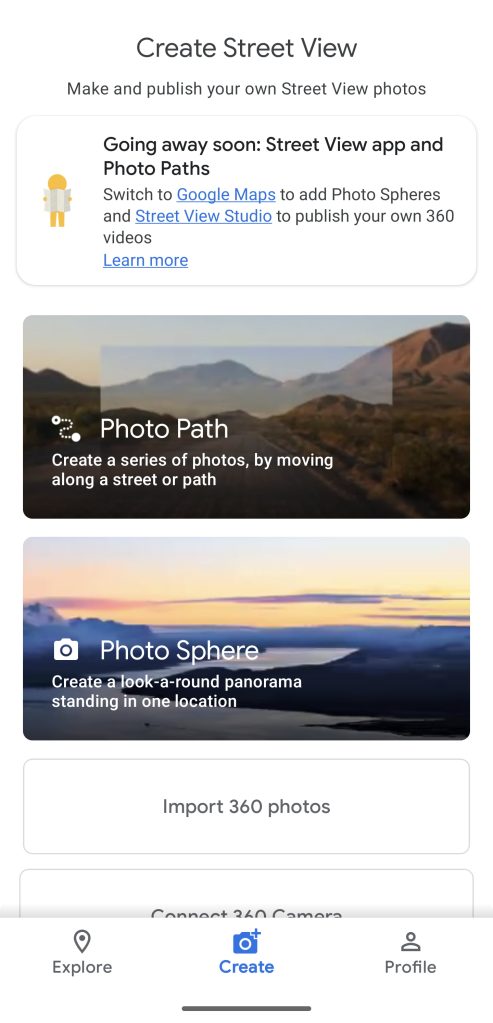
Google is preparing to shut down the dedicated Street View app on Android, keeping the feature in Google Maps.
About APK Insight: In this “APK Insight” post, we’ve decompiled the latest version of an application that Google uploaded to the Play Store. When we decompile these files (called APKs, in the case of Android apps), we’re able to see various lines of code within that hint at possible future features. Keep in mind that Google may or may not ever ship these features, and our interpretation of what they are may be imperfect. We’ll try to enable those that are closer to being finished, however, to show you how they’ll look in case that they do ship. With that in mind, read on.
Google’s Street View is an easy way to get a 360° look at almost any given street on the planet, perfect for getting a sense of your next travel destination or simply exploring the world from the comfort of home. While the Google Maps app has long offered an easy way to hop into Street View, there has also been a dedicated Street View app on Android and iOS.
This standalone app served two distinct groups of people – those who wanted to deeply browse Street View and those who wanted to contribute their own 360° imagery. Considering the more popular Google Maps app has Street View support and Google offers a “Street View Studio” web app for contributors, it should be no surprise to learn that the company is now preparing to shut down the Street View app.
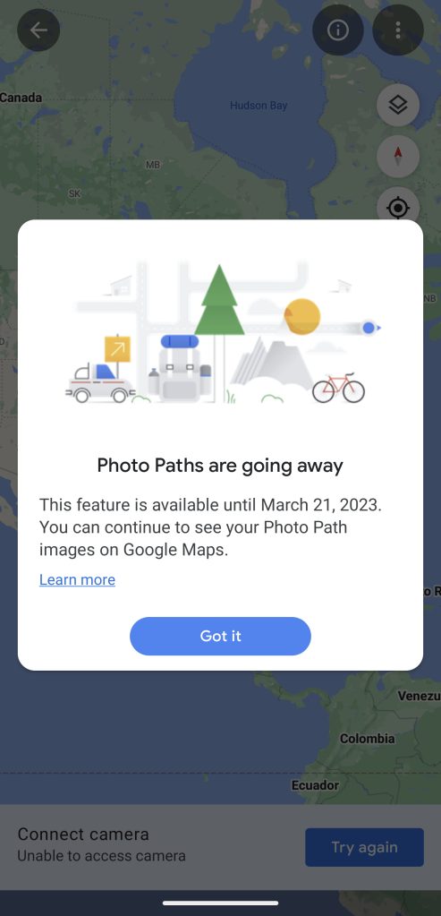
In the latest update, version 2.0.0.484371618, Google has prepared a handful of deprecation/shutdown notices for the Street View app. These notices are not yet visible in the app today, but our team managed to enable them.
In the notice, Google confirms that the Street View app is set to shut down on March 31, 2023, encouraging users to switch to either Google Maps or Street View Studio.
Street View App is going away
The app is going away and support will end March 21, 2023.
To publish your own 360 video, switch to Street View Studio. To view Street View and add Photo Spheres, use Google Maps.


Top comment by TheInfamousCK1 THEInfamousONE
I've mapped out numerous hiking trails some which are not on any maps. My goal "was" to map out as much of the Shawnee National Forest (in Southern Illinois) as possible. This is and has been really helpful to users who hike to determine the terrain before they decide to hike. This helps people decide if the hike is suitable for them and also helps users not get lost while in the forest hiking. I'm one of the biggest contributors for Google Maps, Street Viewer and Google Earth. I really enjoyed creating paths for Google users. Google Trekkers are not happy about the complete disregard of this app. Either way there needs to be a replacement so we can map this world out. We are the modern day "Christopher Columbus" in the digital world. If Google does not create a replacement and let's this fall to the waist side I guarantee another application will take this idea and put it into play. I love Google and always will. I hope people realize the importance of truly mapping out unknown trails, paths and locations.
However, one feature that is being fully shut down with the Street View app’s demise is that of “Photo Paths.” First launched last year, Photo Paths were intended as a way to let nearly anyone with a smartphone contribute simple 2D photos of a road or path that had not yet been documented by Street View. Unlike every other feature of the Street View app, there is no replacement for Photo Paths on the web app or Google Maps app.
Thanks to JEB Decompiler, from which some APK Insight teardowns benefit.
Dylan Roussel contributed to this article.
Header image: Google
FTC: We use income earning auto affiliate links. More.


Comments