It’s wildfire season, and that, unfortunately, means smoke and pollutants are going to be tracking across thousands of miles, affecting air quality and millions of people. Checking the air quality before you step outside is vital, so here’s how to do it using Google apps and Search.
Google Search
Google Search is going to be one of the fastest ways to gather air quality information about not just where you are but in other locations as well. The database is reliably sourced via airnow.gov and NOAA, which means the data is up to date.
Here’s how to do it:
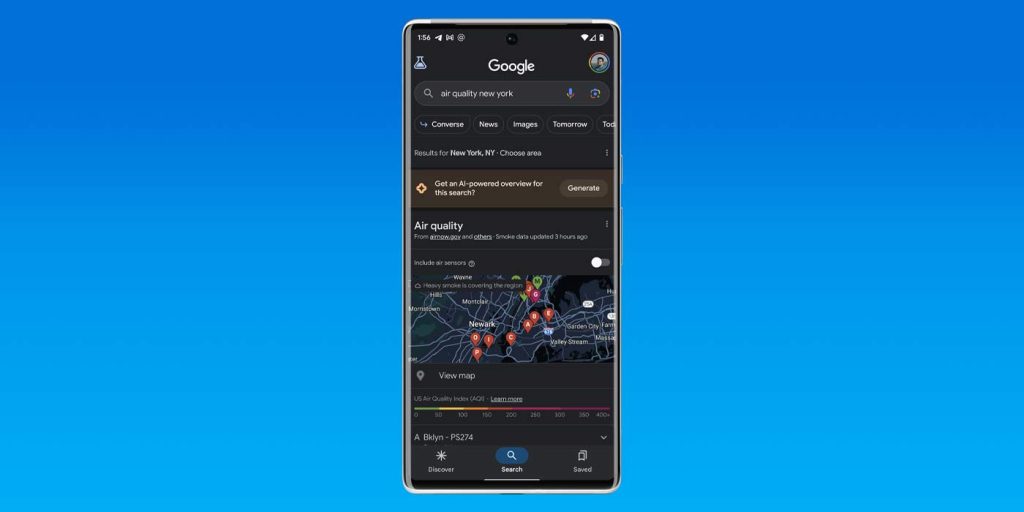
- In Google Search – in any form – enter “Air quality [location].”
Depending on what location you ask for, you should see a map with colored labels. The legend of those colors is right below the map and indicates what the quality value is for that color. For instance, green is anywhere from 0 to 50, while red is 150 to 200. Obviously, the more red or purple the color, the worse the quality is.

Google Maps
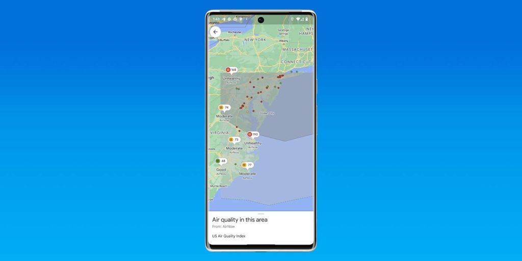
Google Maps introduced a new tool last year that allows users to see an air quality layer in the app. That feature should be available for all and is very easy to access. It comes in handy for those needing to see the extent of a certain event, like a wildfire.
Here’s how to use it:
- In Google Maps, find and hit the layers button.
- Look for and hit Air Quality.
- Tip: If you don’t see it, hit More.

At a Glance on Pixel
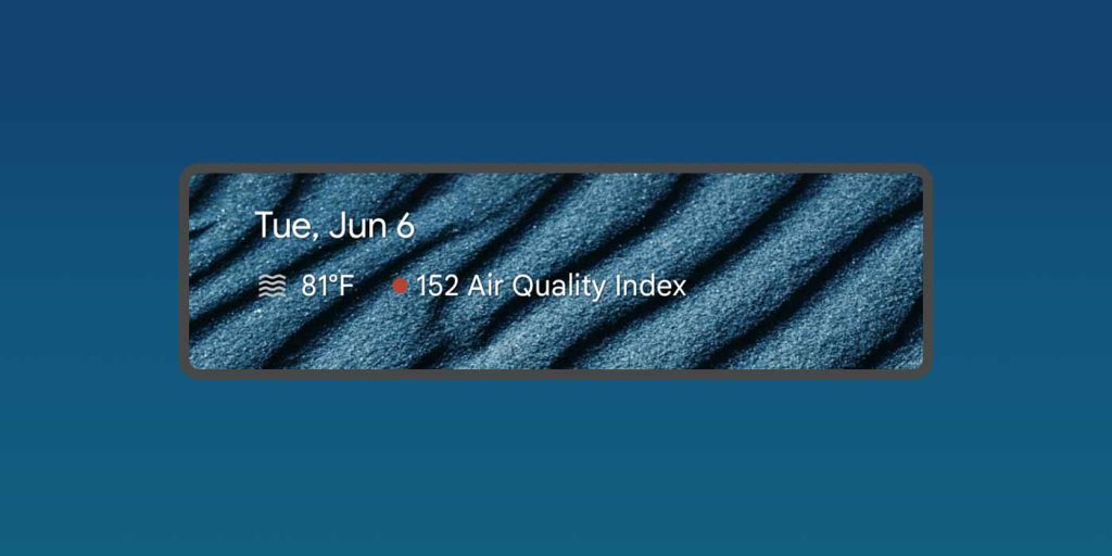
If you own a Pixel device from Google, you’re likely using At a Glance. At a Glance is the text widget that appears at the top of the phone and on the homescreen. During weather events like the wildfires happening in Canada at the time of writing, you’ll see an air quality index value – AQI. While it doesn’t appear often, it usually shows a number and color.

In all, air quality information is easy to access, so long as you know where to look. During bad weather events, make sure you’re taking precautions and only going outdoors if you need to.
FTC: We use income earning auto affiliate links. More.


Comments