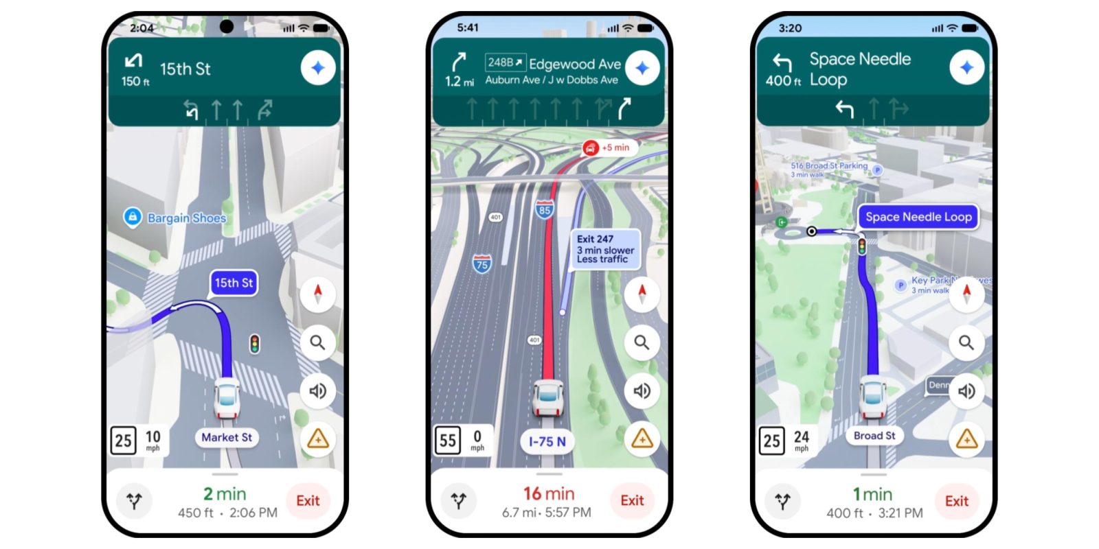
Google Maps is giving its driving experience the “biggest update in over a decade” with Immersive Navigation that redesigns visuals and offers “more intuitive guidance.”
It starts with a “vivid 3D view that reflects the buildings, overpasses, and terrain around you.” Google Maps will highlight lanes, crosswalks, traffic lights, stop signs, and other critical road details “to help you make that turn or merge confidently.”
Google Maps rolling out conversational ‘Ask Maps’ chat
Google will help you “prepare for your next move” by showing a broader view of the route. This includes smart zooms and transparent buildings ahead of tricky turns and lane changes.
Helpful visuals are paired with more natural voice guidance like: “Go past this exit and take the next one for Illinois 43 South.”
Top comment by JaggedXJ
At least give me the option to ALWAYS display the exit number of my next turn. Exit for "Hwy 123 West" is a LOT less useful than "Exit 54C" 99% of the time. And Google knows this since it will show the exit # once you are 2(?) miles away.
And I'll never understand why if I'm on say i-95, I'll have a direction to stay on i-95 in 8mi that doesn't involve a maneuver or course adjustment of any kind. As long as you don't take an exit, you'll be on the same road for many miles until a REAL way point.
To be clear, it should be enter highway, stay on highway for 22mi until exit 4, exit 4 is in 2 miles.
NOT enter highway, stay on Hwy in 10 miles, stay on Hwy in 16 miles, stay on Hwy in 3.6mi, exit in 1mi. Especially if you don't so much as need to change lanes to continue on your journey. Garmin and other navigation companies have had it figured out for decades!
Google Maps is leveraging Gemini for spatial understanding. The models are used to “analyze fresh, real world imagery from Street View and aerial photos to give you an accurate view of things along your route, like landmarks and medians.”
Maps will now inform you about tradeoffs for alternate routes, like a “longer trip with less traffic or a faster one with a toll.”
We’ll also alert you to real-time disruptions along your route, like road construction and crashes – powered by our community of drivers, who provide more than 10 million of these contributions every single day.
Before starting, Google will also let you “preview your destination and its surroundings with Street View imagery, and get recommendations for where to park.”
As you approach, Maps will highlight the building’s entrance, nearby parking, and which side of the street to be on—so you can go from the last turn to the front door with confidence.
Immersive Navigation is beginning to roll out today in the US. Google says “availability will expand over the coming months to eligible iOS and Android devices, CarPlay, Android Auto and cars with Google built-in” (Android Automotive).
FTC: We use income earning auto affiliate links. More.

Comments