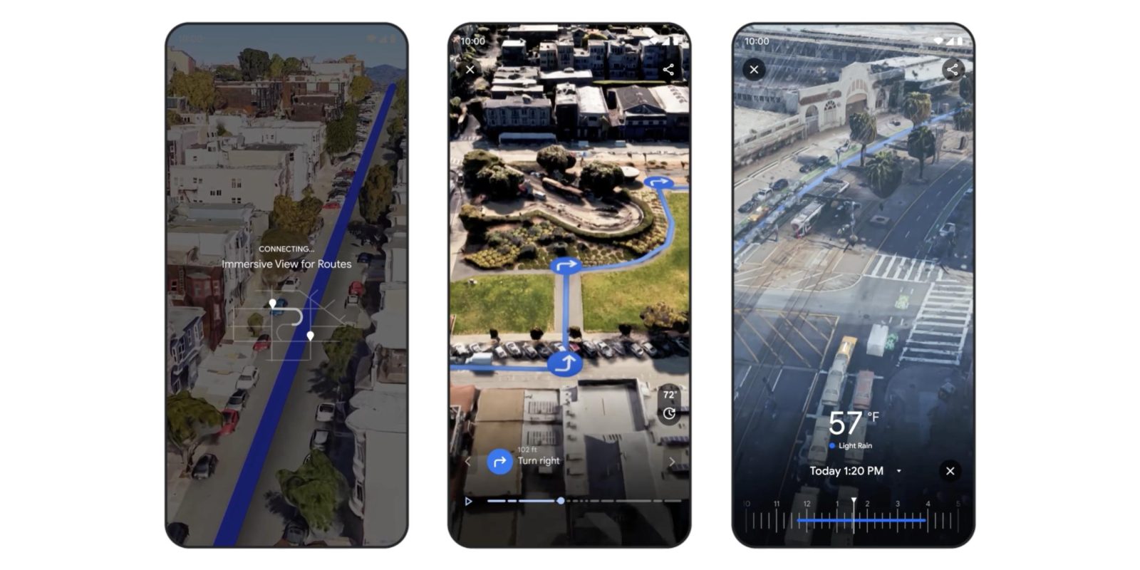
Announced at I/O, Google Maps is now rolling out “Immersive View for routes” and a number of other search and navigation features.
Immersive View for places lets you view landmarks and even restaurants in 3D under various conditions, like time of day and different weather. It works by using AI to “fuse together billions of Street View and aerial images.”
Google Maps is now extending that capability to routes to give you an idea of what to expect on a turn-by-turn basis. In addition to weather and simulated lighting, you can get an idea of what traffic will be like.
You can prepare for each turn as if you were there with detailed, visual turn-by-turn directions, and use the time slider to plan when to head out based on helpful information, like simulated traffic and weather conditions. That way, you can easily avoid riding during rainy weather or heavy traffic.
When getting directions (walking, cycling, or driving), you’ll see a button to launch Immersive View. It takes a moment to load (as this is streamed from the cloud), and then you can preview every step of your journey, from crosswalks to turns, and see what else is nearby.
Immersive View for routes is rolling out this week to Google Maps for Android and iOS in Amsterdam, Barcelona, Dublin, Florence, Las Vegas, London, Los Angeles, Miami, New York, Paris, San Francisco, San Jose, Seattle, Tokyo, and Venice.
Meanwhile, Google Lens, which can be launched in the Maps search bar, now works in 50 new cities starting this week — including Austin, Las Vegas, Rome, São Paulo, and Taipei — to provide you with an AR overlay of what stores and locations are available nearby. This feature is officially being renamed to “Lens in Maps” from “Search with Live View.”
Google Maps search is being updated to support queries like “animal latte art” and “pumpkin patch with my dog.” Google will search for user-uploaded imagery that features these items and note where they were taken. You can also get a map view with pins showing those photos. This is rolling out starting this week on Android and iOS in France, Germany, Japan, the UK, and the US.
Search in Maps is also getting better at supporting general queries. For example, “things to do in Tokyo” will surface sets of places to visit, such as art exhibitions and cherry blossoms. These recommendations appear as card carousels and are coming later this year.
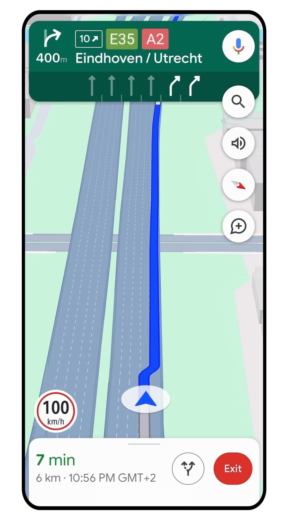
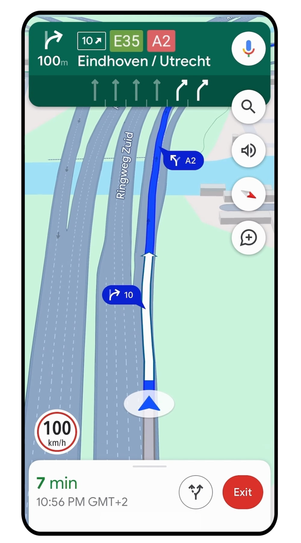
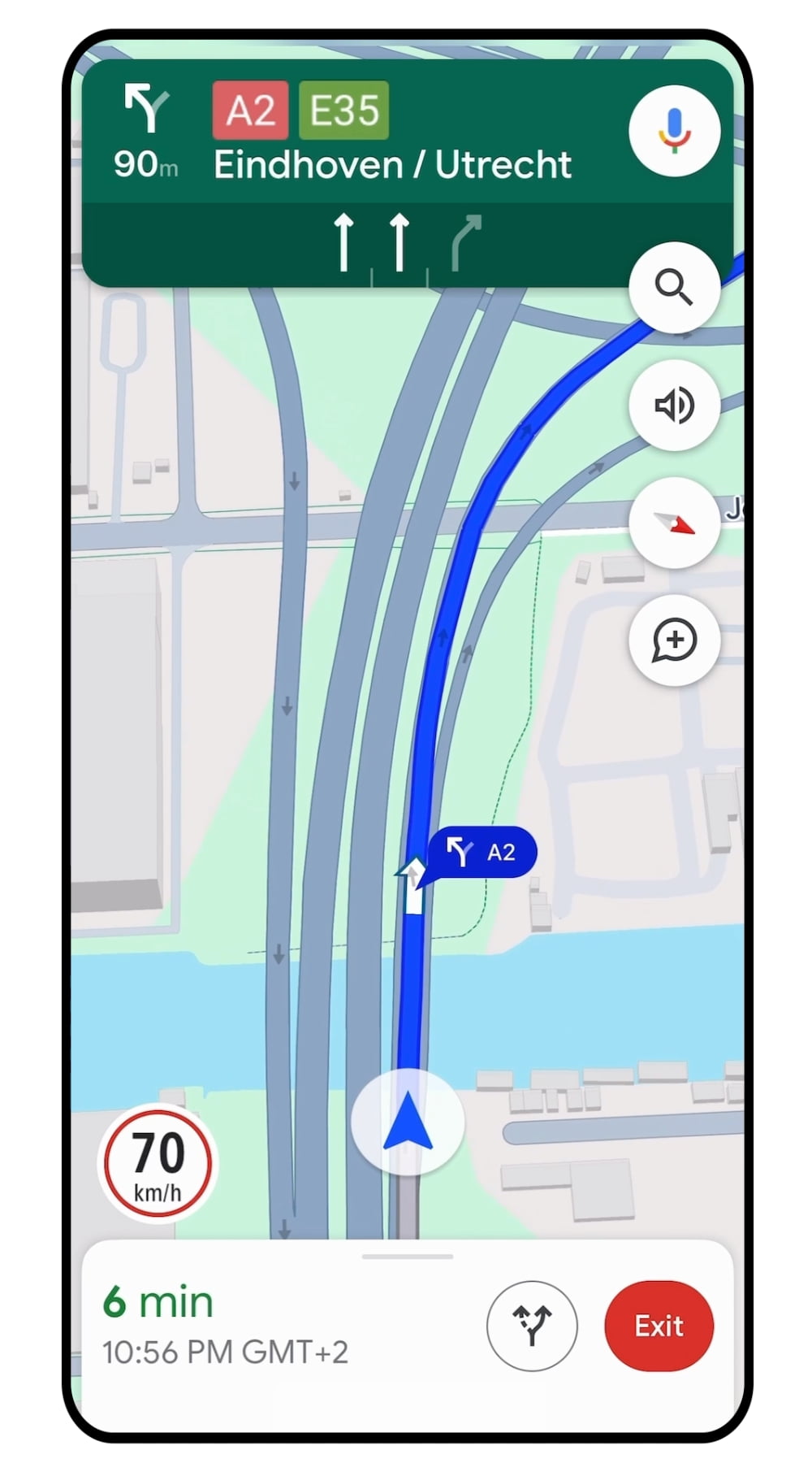
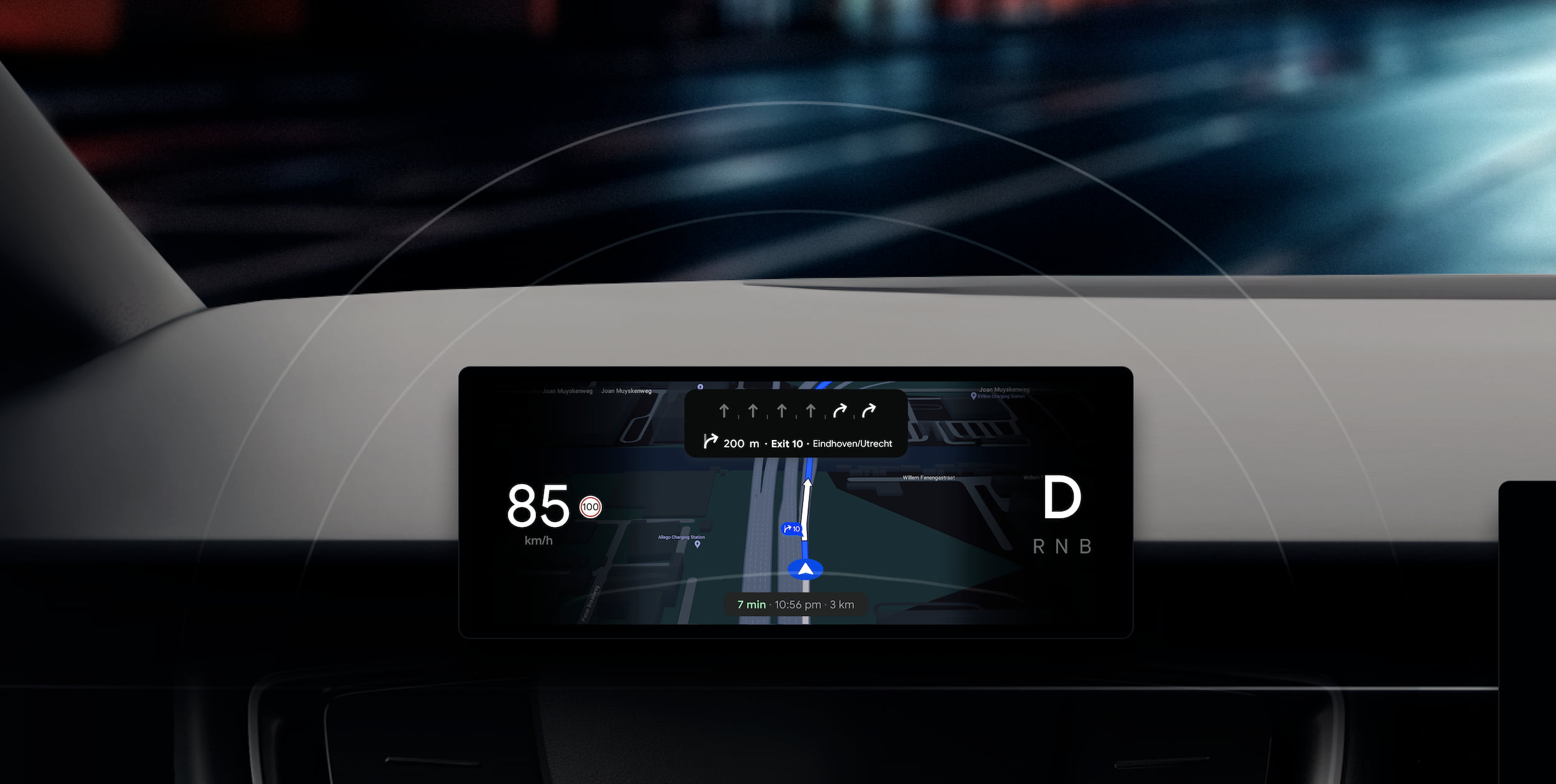
Google is updating the navigation map to “reflect the real world even more accurately” with updated colors, more realistic depictions of buildings, and improved lane details that better indicate when you have to change. This is rolling out in the coming months to Belgium, Canada, Denmark, France, Germany, Great Britain, Japan, Luxembourg, Netherlands, Sweden, and the US.
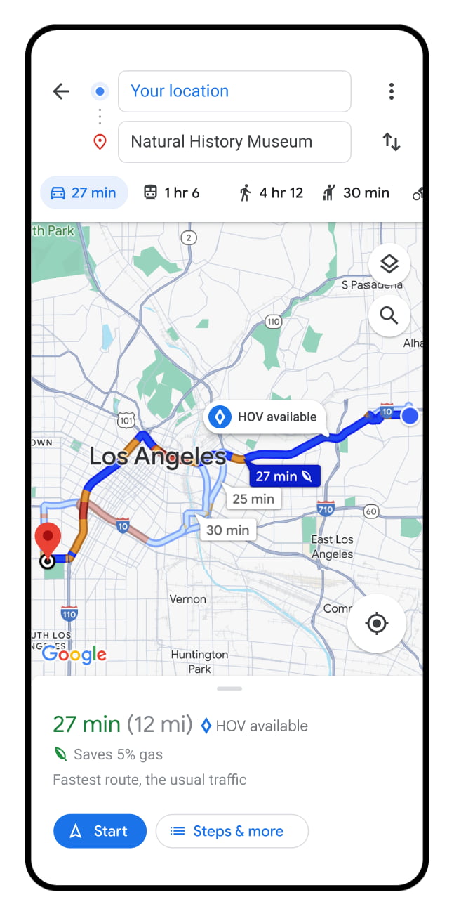
Google is also surfacing HOV lanes in the US (over the coming months), while speed limit information is coming to 20 European countries — including Austria, Czech Republic, Denmark, Finland, Germany, Greece, and Switzerland — in a similar time frame.
For EV owners, Google Maps search results will get better at showing plug types and whether you’ll get slow/medium/fast charging, while Google will note when a charging station was last used — like “Used today” — to give you a better idea of its working. This is rolling out globally on Android and iOS starting this week. On the developer front, Google is bringing EV charging information to the Maps Platform Places API for third-party usage.
FTC: We use income earning auto affiliate links. More.



Comments