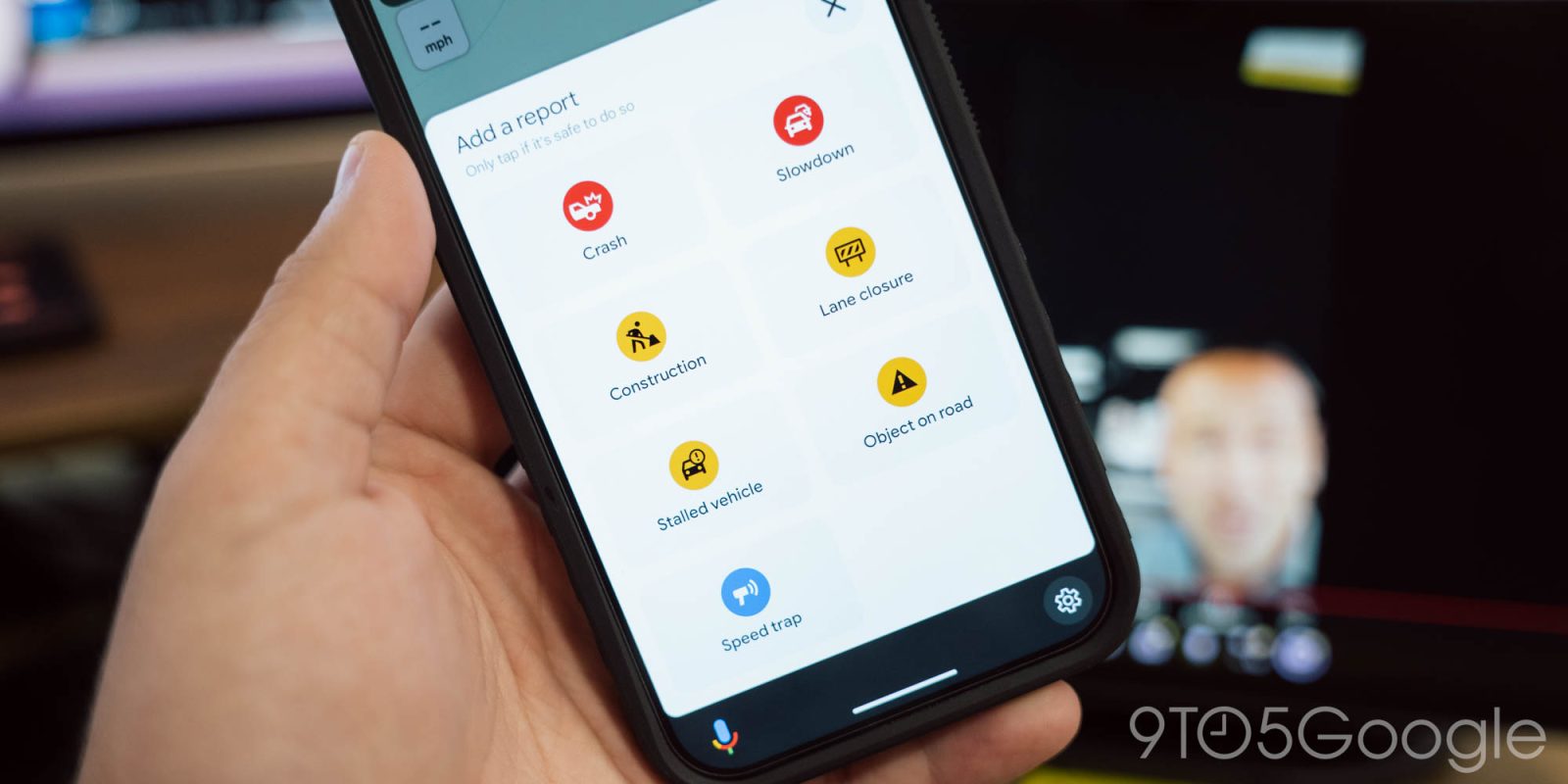
Google Maps and Waze both have features that allow users to report police activity along their route, and in a bid to use that for safety, the Illinois State Police has partnered with Google to show the locations of traffic stop or other activity as reported by the police themselves.
As it stands today, incident reporting in Google Maps and Waze is largely used to report speed traps along the road, but Waze, at least, can also report a police officer on the roadway. Both platforms can also accept user reports of crashes, slowdowns, and disabled vehicles.
In Illinois, the State Police has partnered with Google to expand a notification system to Maps and Waze which shows the location of officers through the state. The idea is to improve driver awareness and and safety around officers that are attending to accidents or performing traffic stops, in accordance with the state’s “Move Over” law which mandates that drivers change lanes when approaching emergency vehicles and other stopped vehicles on the side of the road.
Incident information will appear in Google Maps and Waze as reported by the police, rather than relying only on users. The information will move through Google Cloud to populate it within the two services.
The Illinois State Police explains:
To alert drivers to slow down and move over, a message about a crash, traffic stop, motorist assist, or debris in the roadway is generated by [Illinois State Police (ISP)]. That message, along with the officer’s GPS coordinates are fed to Google Cloud where it is transformed and sent to Waze. As drivers approach the GPS location of the ISP trooper, they will see a police, crash, or disabled vehicle icon on the screen of their map and receive an alert to slow down and move over. Similar icons will appear on Google Maps in the coming weeks.
This applies to crashes and disabled vehicles as well as traffic stops, but it doesn’t sound like it will apply to speed traps, which users can still report themselves. The reports will start showing in Waze soon, and Google Maps “in the coming weeks.”
More on Google Maps:
- Android Auto’s incident reporting feature might not work in your car – here’s why
- Handy Android Auto trick lets you easily look ahead on your Google Maps route
- Google Maps warning shows which business profiles might have fake reviews
Follow Ben: Twitter/X, Threads, Bluesky, and Instagram
FTC: We use income earning auto affiliate links. More.
Comments