Waze


Google just announced a few updates rolling out to the new Google Maps desktop app today. Users will now be able to highlight StreetView imagery, user-uploaded photos, and PhotoSpheres on the map by clicking a new pegman icon in the lower right corner of their screen (pictured above). StreetView imagery will be highlighted in light blue, Photo Spheres as darker blue circles, and indoor imagery as yellow circles.
In addition, the update brings a touch of Google Earth over to the Maps desktop app with new bird’s-eye view 3D Earth Tours for all WebGL-enabled browsers.
Explore beautiful, 3D imagery of buildings and terrain for thousands of locations from above with Earth Tours available right in your browser.* Wherever you see the Earth Tour icon, you can click, sit back, and get a virtual tour from a soaring angle. Dive into Boston or circle the Alps.

Google is also rolling out a new preview UI for directions. Now, when viewing individual steps for directions you’ll see StreetView imagery on each step where available, allowing you to get a better sense of your surroundings for an upcoming turn or exit. Google also notes that it has integrated real time traffic incident reports from its Waze acquisition like it recently did in its mobile Google Maps apps.
The new Google Maps desktop app is rolling out to all that opted into the new Google Maps preview today and to everyone else in teh coming weeks. Google also just released a video preview for the new Google Maps desktop experience that shows off some of the new features in today’s update:
Expand
Expanding
Close
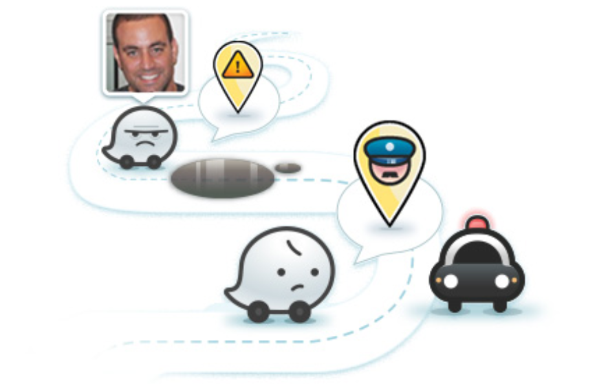
 Google announced today on its Google Maps blog that it’s finally tapping into the talent and technology it picked up with its acquisition of Waze back in June to integrate real time incident reports from Waze into Google Maps. The new integration means that when Waze users report incidents for everything from accidents to road closures, Google Maps users on both iOS and Android will now be able to benefit:
Users of Google Maps for Mobile will now benefit from real time incident reports from Waze users. This means when Wazers report accidents, construction, road closures and more on Waze, the updates will also appear on the Google Maps app for Android and iOS.
The features will initially be limited to users in certain locations, including: Argentina, Brazil, Chile, Colombia, Ecuador, France, Germany, Mexico, Panama, Peru, Switzerland, UK and the US. In addition, as Google first hinted back in June, the company will also be integrating Google Search into the Waze apps on iOS and Android, while the Waze Map Editor now has access to Google Street View imagery:
Expand
Expanding
Close
The idea that Google could lose ownership of Waze less than ten days after buying it for a rumored billion dollars might sound incredible, but that’s the intriguing possibility raised by a law professor from Ohio State University writing in the New York Times.
The law requires companies to make what’s known as a Hart-Scott-Rodino filing for any intended acquisition so that the proposed deal can be checked for anti-trust issues before it takes place. Google apparently didn’t make this filing.
According to a person close to Google, the company skipped the Hart-Scott-Rodino filing by relying on an exemption. This filing is not required if the acquisition is of a foreign company that has sales and assets in the United States of less than $60.9 million. Waze is an Israeli company with headquarters in Silicon Valley, so it comes under this test.
Waze probably doesn’t have $50 million in revenue worldwide, yet the test also looks at assets. Given that Waze is worth $1 billion, it is hard to see that the value of its intellectual property in the United States business doesn’t meet the test. And the F.T.C. has previously indicated that companies should include this type of intellectual property in informal guidance …
Expand
Expanding
Close
Bloomberg reports that Google is considering making an acquisition offer for mapping company Waze. Numerous reports over the past few weeks have claimed that Facebook is also eyeing an acquisition of the maps firm.
Google Inc. (GOOG), maker of the Android operating system, is considering buying map-software provider Waze Inc., setting up a possible bidding war with Facebook Inc., people familiar with the matter said. Waze is fielding expressions of interest from multiple parties and is seeking more than $1 billion, said one of the people, who asked not to be identified because the talks are private. The Palo Alto, California-based startup might also remain independent, instead seeking to raise a round of venture capital financing, the people said.
Waze’s price-tag is current said to be around $1 billion.
Google’s potential bid would likely create a bidding war with the Menlo Park-based social network. Bloomberg reiterates that Apple is not in discussions with Waze. Rumors from earlier this year claimed that Apple was eyeing an acquisition, but many of those claims were immediately debunked.
Google is sponsoring an upcoming hackathon by Hattery Labs that is awarding two grand prizes to innovators using Google Maps API.
The “Reroute/sf” hackathon runs from Oct. 19 to Oct. 21 at The Hattery, according to its Facebook page, and it aims to “improve transportation in San Francisco with technological innovation, and work with the City to make it real.” The three-day event essentially invites engineers, designers, and entrepreneurs to “make San Francisco a better place.”
The hackathon will host three challenges, i.e., “Collect the right data,” “Plan a trip anywhere – on-time,” “See what’s broken and watch it get fixed,” while senior representatives from the City of San Francisco and the technology community will determine who wins the following four prizes:
Aside from Google, the Hattery, the San Francisco Mayor’s Office, San Francisco Municipal Transportation Agency, Waze, Google Maps, and the General Assembly sponsor the hackathon. The Hattery is a collection of experts ranging from designers and engineers to investors and brand marketers, and some of their most notable collaborative work under Hattery Labs includes giving people clean water and helping Haitians rebuild schools through WellDone and Haiti School Project, respectively.
Registration details below.